We utilize underwater and aerial drones to inspect safely.
We are utilizing underwater drones to work on acquiring more useful data in the inspection of underwater and subsea structures, which has reduced the workload of divers, ensured safety, and reduced the cost of underwater operations.
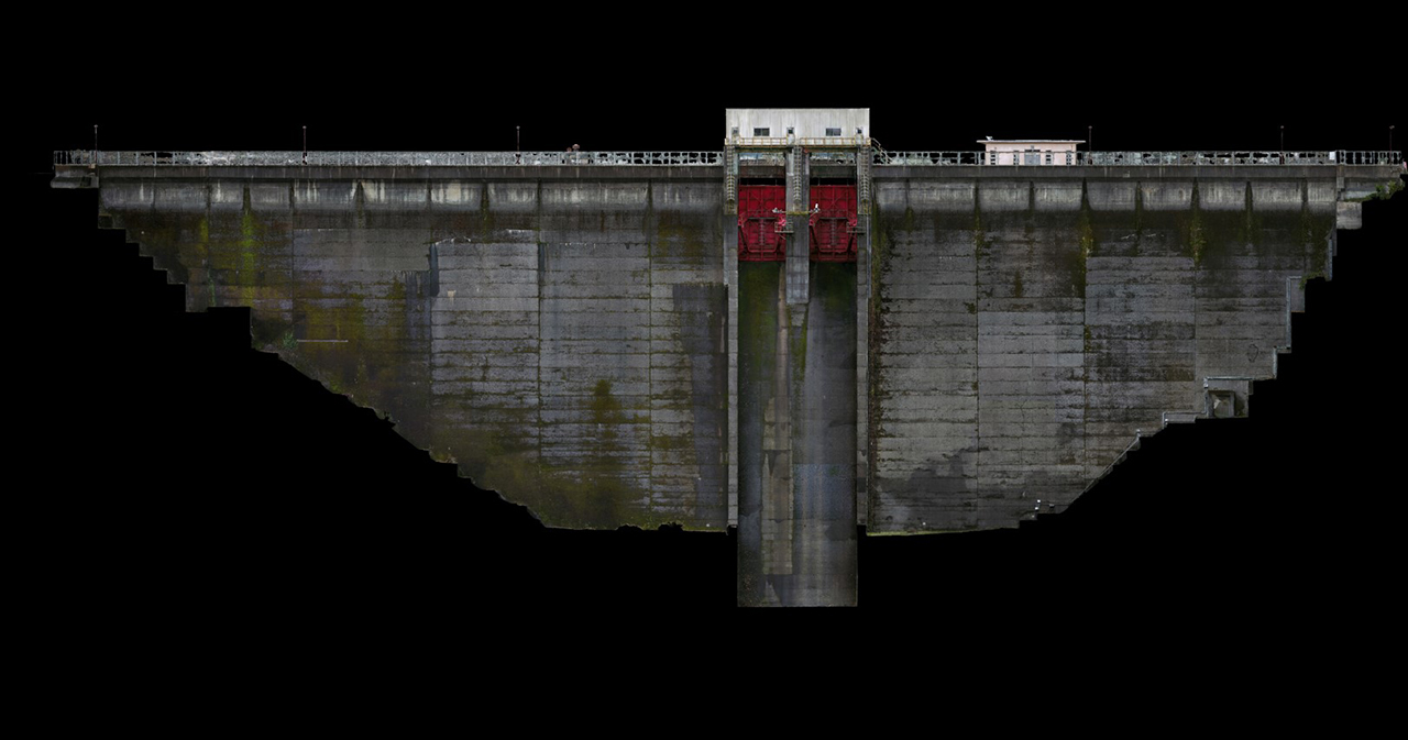
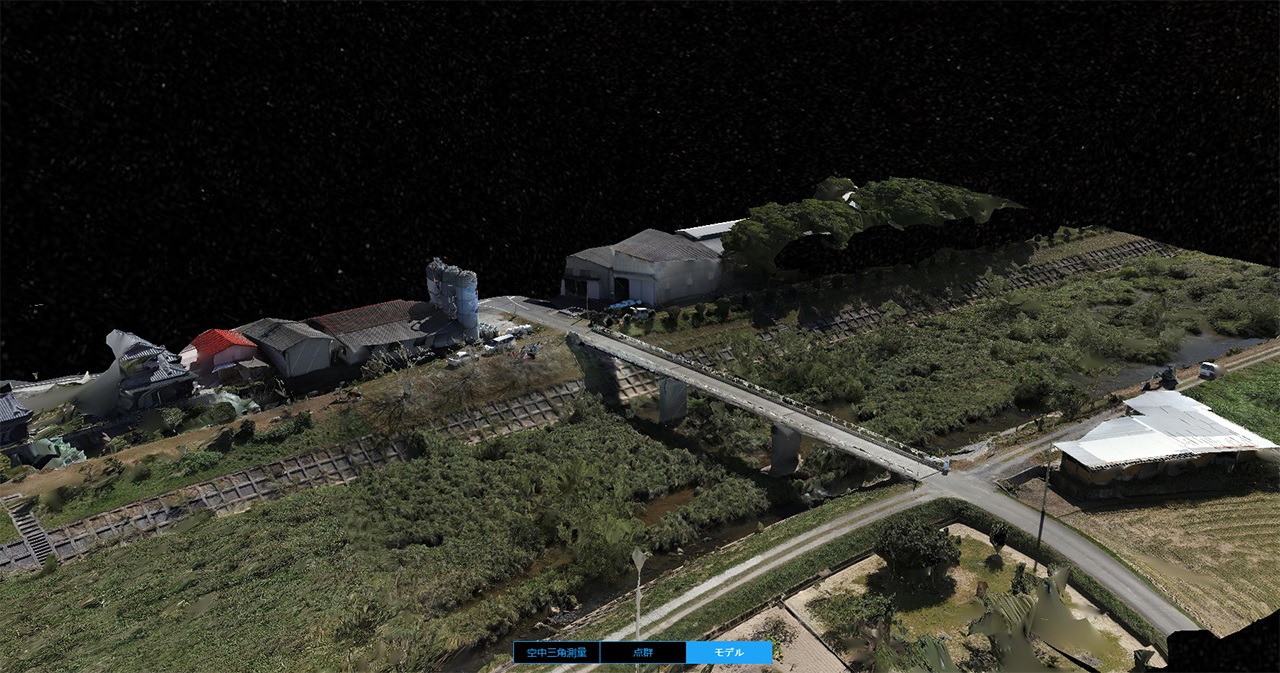
We also make effective use of aerial drones for infrastructure inspections of civil engineering structures such as bridges and steel towers by creating orthoimages from aerial photography, converting them to 3D, and creating point cloud data.
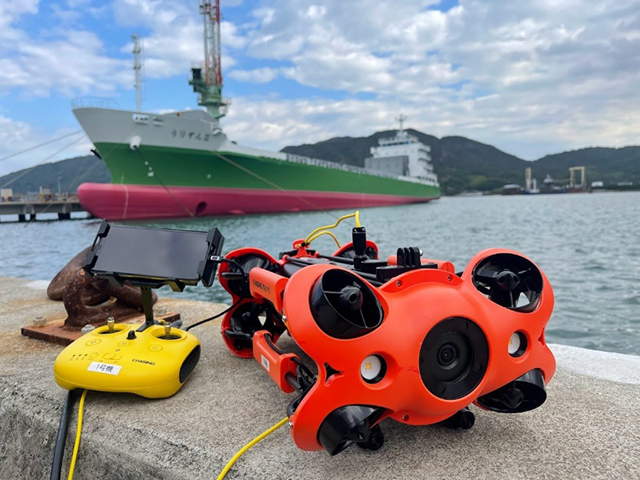
Underwater Drone
The use of underwater drones will enable photographing, inspecting, and surveying of underwater structures, reduce the workload of divers, ensure safety, and improve workability, and reduce the overall cost of diving operations.
Our underwater drones can dive to depths of up to 150 meters. Equipped with a robotic arm, it can also collect samples underwater. The laser scaler onboard the drone makes it possible to measure the distance underwater. Video images are displayed on the operator's monitor in real time, allowing the operator to check the situation.
Aerial Drone
Aerial drone can create high resolution orthomosaic imagery from medium to wide area for urban planning and precise land surveying.
It can also take aerial photographs for 3D modeling, create high precision 3D models and 3D imagery, create point cloud data, and restore drawings.
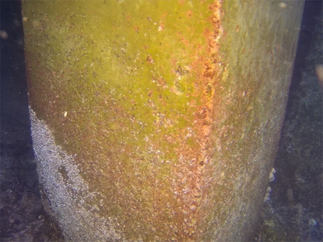
Structure Inspection with Underwater Drone
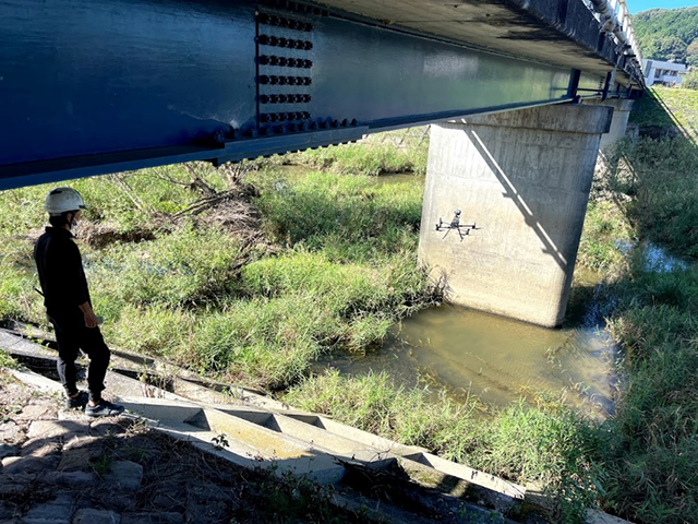
Bridge inspection using a drone
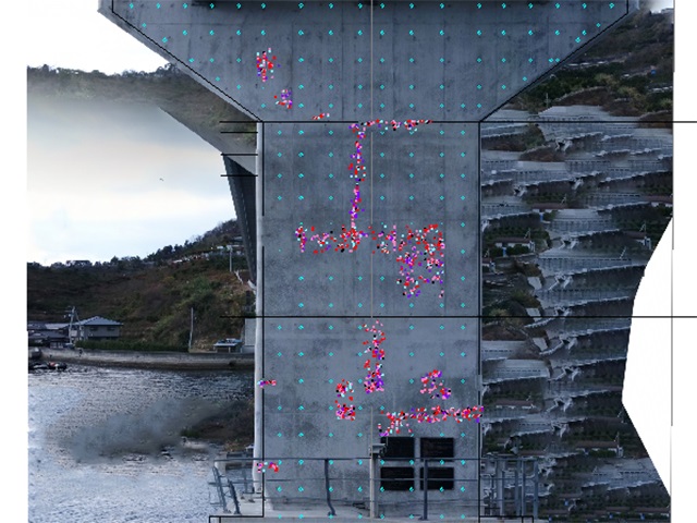
Crack detection from aerial imagery
Photogrammetry (analyzing imagery)3D modeling of bridges