We provide advanced technology using the latest equipment.
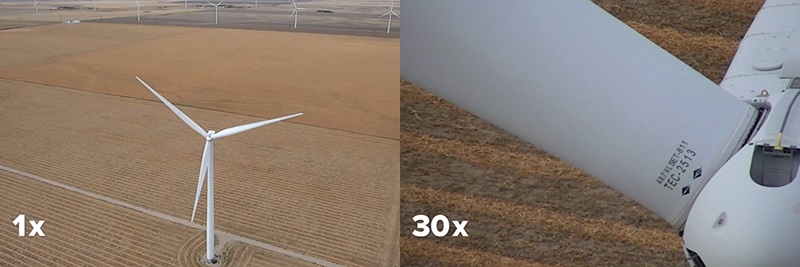
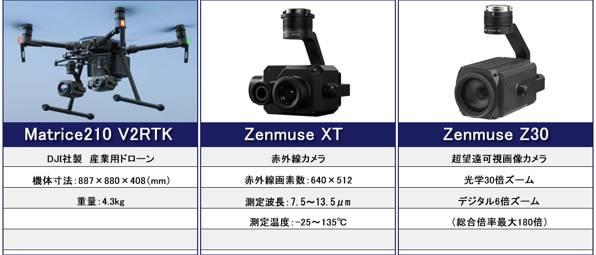
We provide highly accurate survey results using drones, which have been in increasing demand for a wide range of applications in recent years, equipped with high-performance infrared cameras and 4K-resolution visible cameras.
The onboard "RTK system" is used to obtain more accurate position information than GPS by combining not only satellite data but also correction information transmitted from ground reference stations to correct for misalignment.
It also has an ultrasonic anti-collision function, enabling safe, automated drone surveying.